From Reality to Accurate 3D Intelligence

Professional Service Providers for
3D Laser Scanning & Reality Capture

High-accuracy 3D laser scanning, scan-to-BIM, digital documentation and spatial intelligence solutions across infrastructure, in

ABOUT AVRDUS

Capture. Convert. Deliver.

AVRDUS is an experienced 3D laser scanning service provider helping industries capture existing buildings, plants, equipment, and sites into highly accurate digital 3D models.

We transform physical spaces into intelligent data for:

Our workflow ensures accuracy, transparency, speed, and cost efficiency — delivered by a dedicated team of technical and industry experts.

OUR CORE SERVICES

Complete 3D Laser Scanning & Scan-to-BIM Solutions

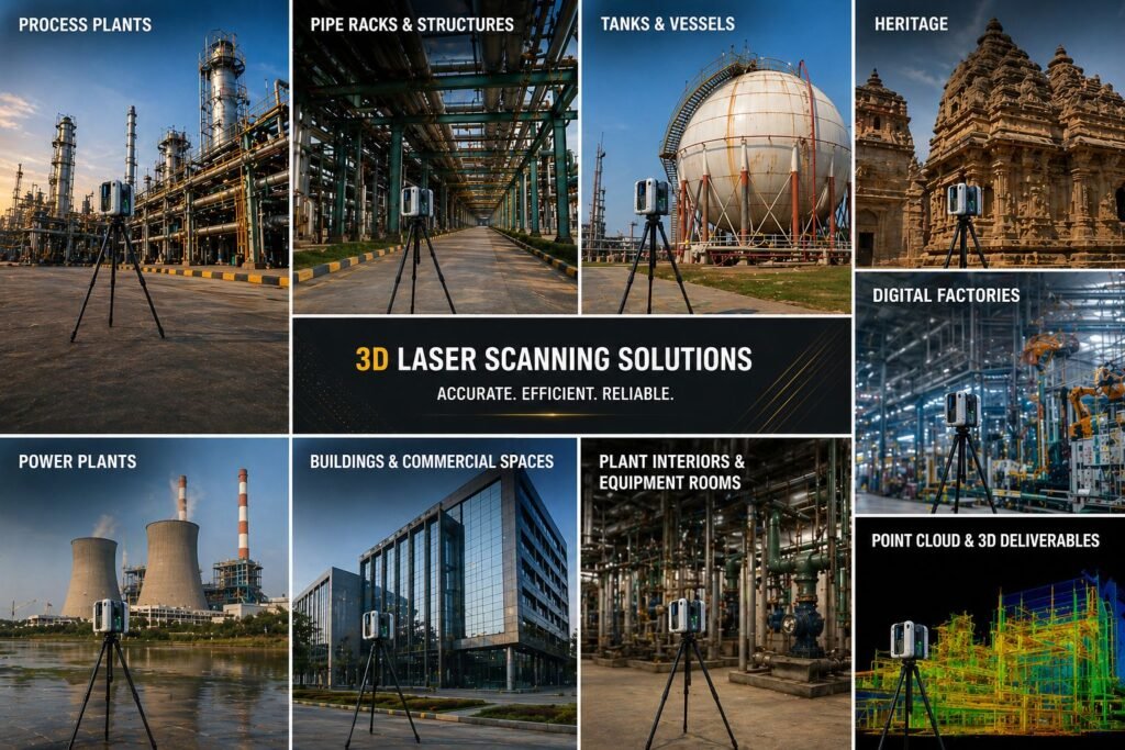
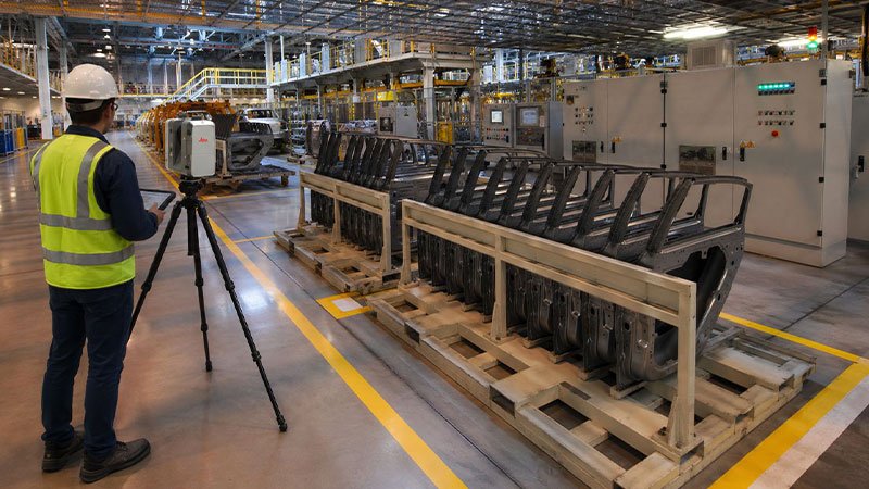
Industrial, Process & Automotive Plants

Capture complex industrial assets including pipelines, refineries, steel and automotive plants, and machinery layouts for plant expansion, digital twin creation, and clash detection.

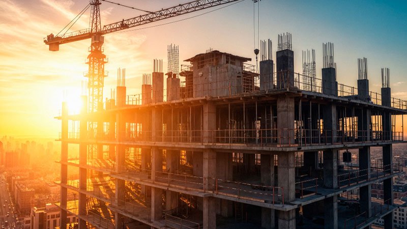
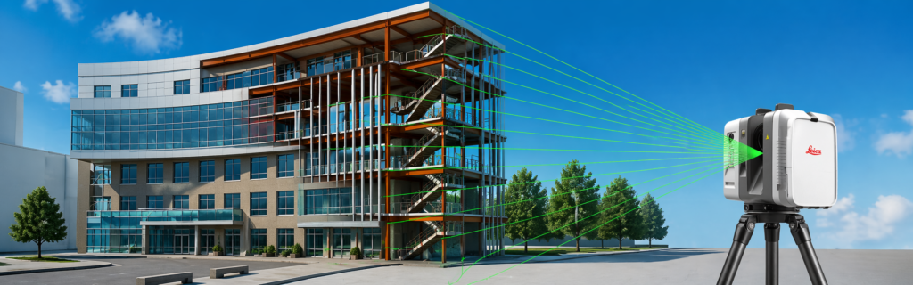
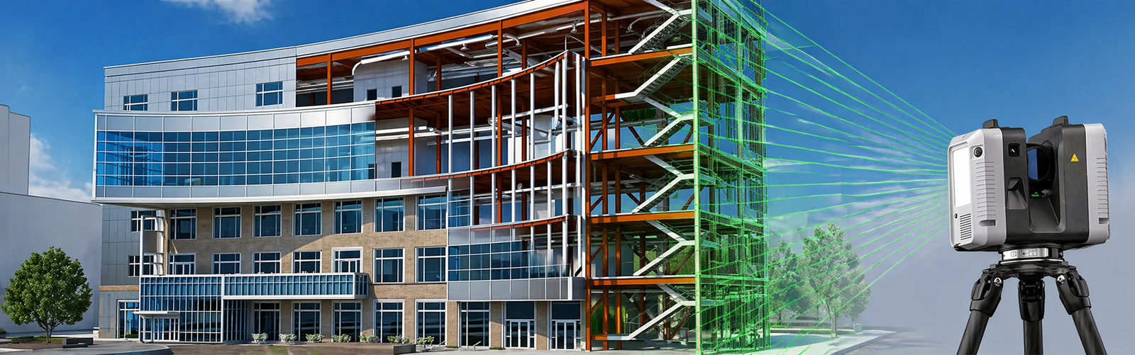
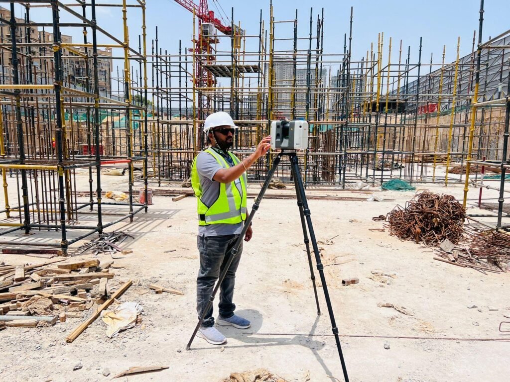
Real Estate & Construction

Capture construction sites and built assets with high accuracy for progress monitoring, quality assurance, digital twins, and faster decision-making.
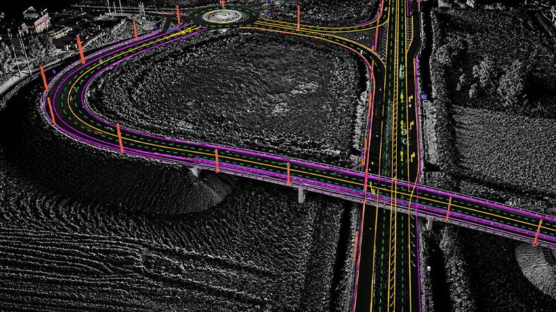
Infrastructure

Capture large-scale infrastructure assets including roads, rail, bridges, airports, and utilities with high accuracy for progress monitoring, asset optimization, and lifecycle management.

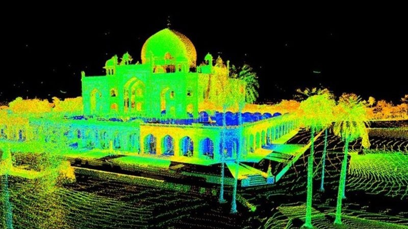
Heritage & Cultural Preservation

Capture heritage sites, monuments, and historic structures with high accuracy for documentation, restoration, digital archives, and conservation planning.

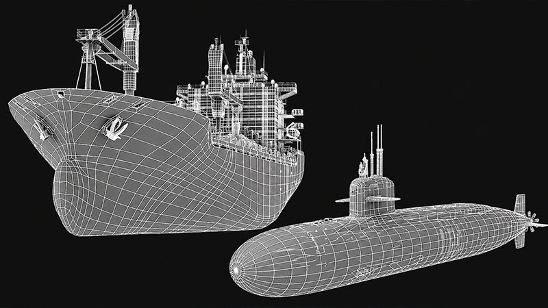
Marine & Ship-building

Capture ships, shipyards, and marine structures with high accuracy for retrofit, maintenance planning, asset management, and design validation.

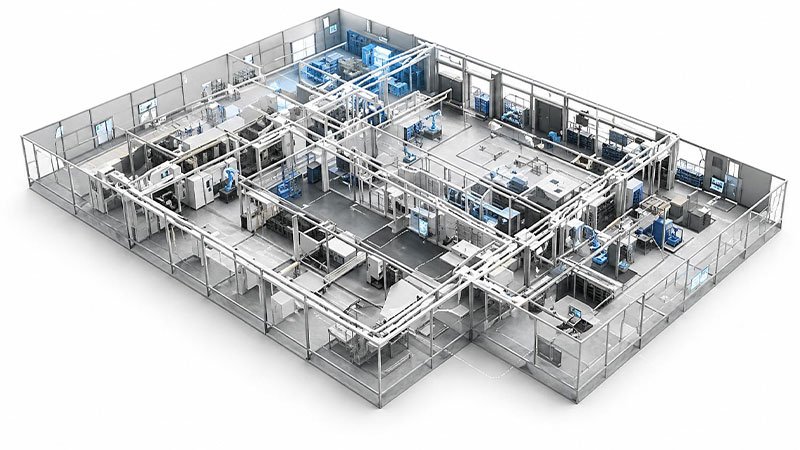
Manufacturing & Digital Factories

Capture manufacturing facilities and production lines with high accuracy for layout optimization, process planning, and asset management.

OUR DELIVERABLES

Actionable digital outputs that transform real-world assets into accurate, decision-ready insights: 3D Point Cloud Data 3D Mesh & Surface Models As-Built Drawings (Plans, Elevations & Sections) 3D Models & Spatial Layouts Construction Verification & QA/QC Reports Progress Tracking & Documentation Layout Validation & Clash Detection Virtual Walkthroughs & Site Visualization Gaussian Splatting & Immersive Visualizations Volume & Capacity Analysis Asset Documentation & Measurements Retrofit & Expansion Planning Support

WHY AVRDUS?

AVRDUS brings together precision, scale, and deep expertise to deliver reliable reality capture solutions across India. With one of the country’s largest 3D scanning fleets — including Leica, FARO, ZEISS, and FJD systems across terrestrial, mobile, and SLAM technologies — we are equipped to handle projects of any size and complexity. Our team of 50+ specialists spans engineering, on-site data capture, and advanced processing, ensuring high-accuracy outputs that enable confident decision-making. With a strong presence across Delhi NCR, Mumbai, Pune, Bangalore, Hyderabad, Chennai, and Kolkata, we deliver faster turnaround times while reducing project risk. From single-site requirements to large multi-location deployments, our scalable and cost-efficient approach ensures consistent quality without compromise. Backed by experienced leadership and a deep understanding of project requirements, we focus on aligning every deliverable with your end goals — because for us, execution starts with understanding.

HARDWARE SOLUTIONS

Industry-Leading Leica 3D Laser Scanners & Mobile Mapping Systems

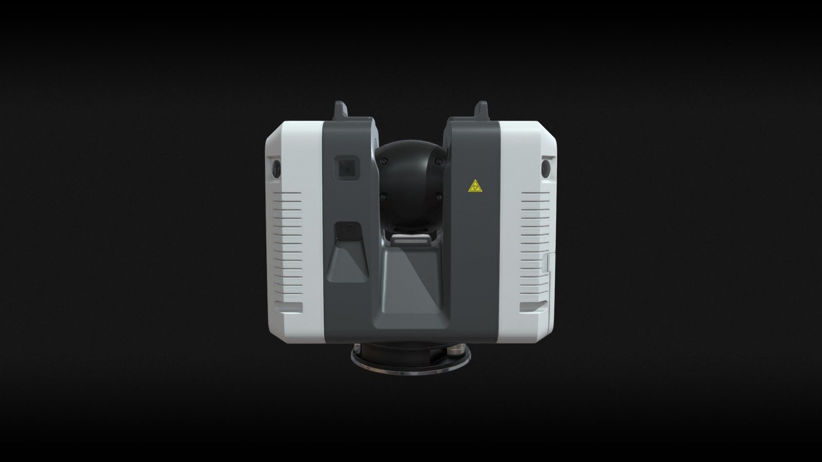
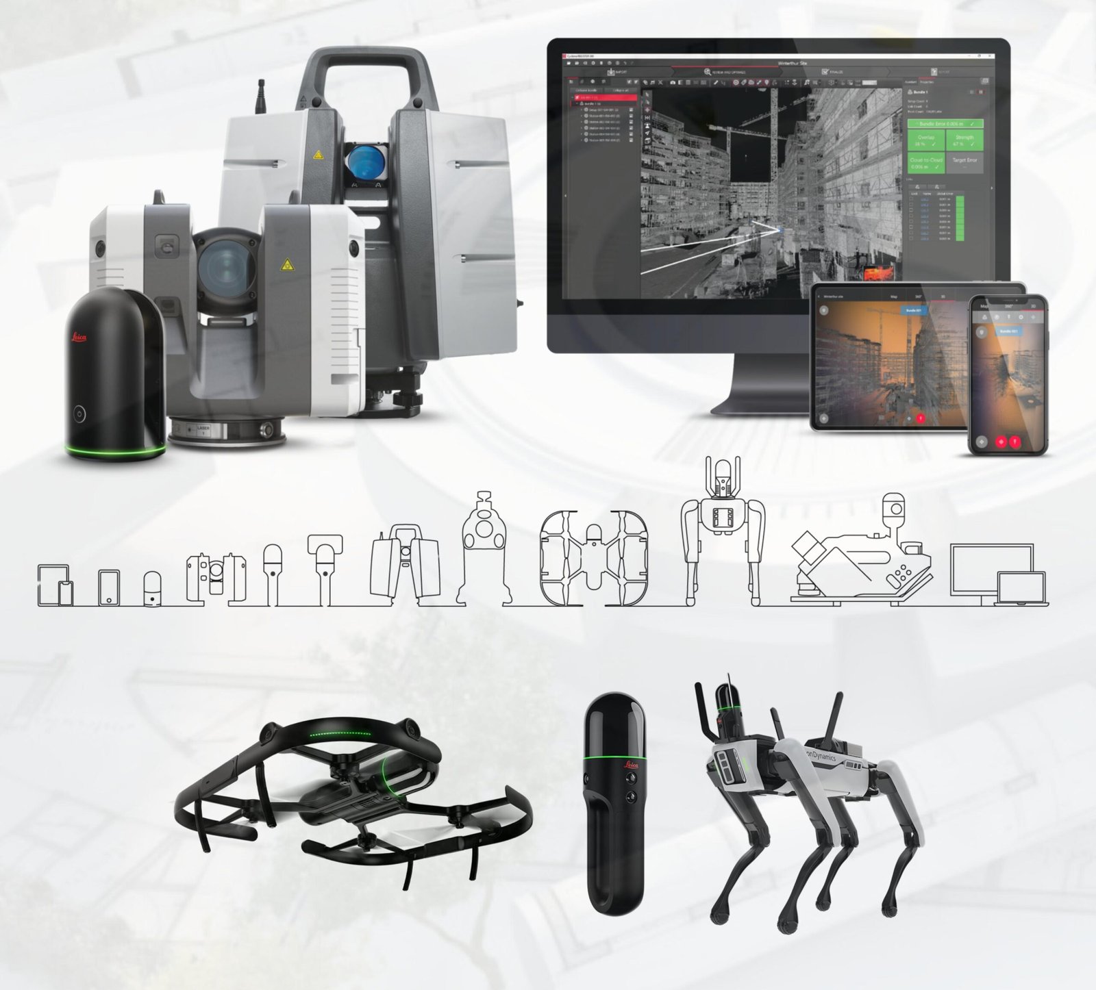
Leica RTC360 3D Laser Scanner

High-speed, high-accuracy scanning with automated field pre-registration for complex projects.
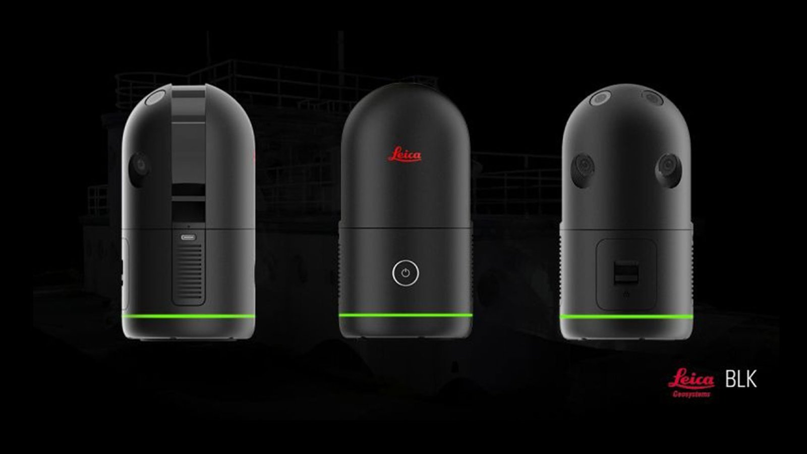
Leica BLK360

Compact and user-friendly 3D imaging laser scanner with full-colour panoramic capture.
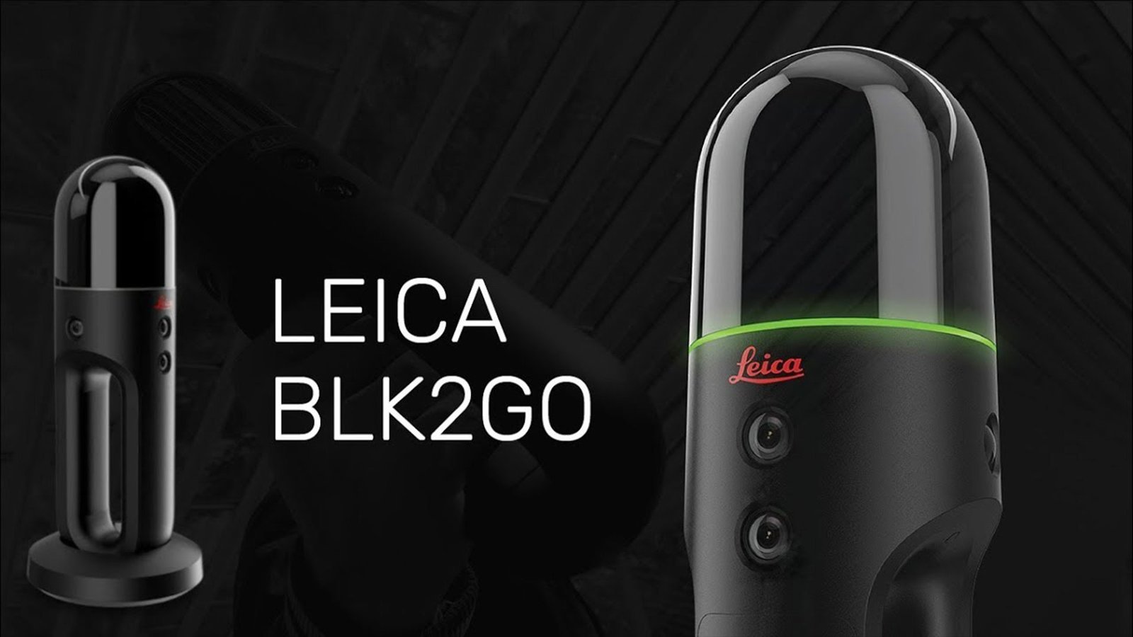
Leica BLK2GO

Handheld SLAM-based mobile scanner for real-time indoor and outdoor spatial mapping.
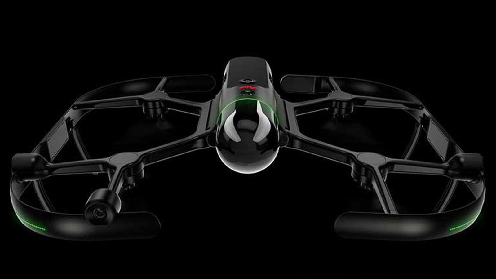
Leica BLK2FLY

Autonomous flying laser scanner designed for rooftops, facades, and hard-to-reach areas.
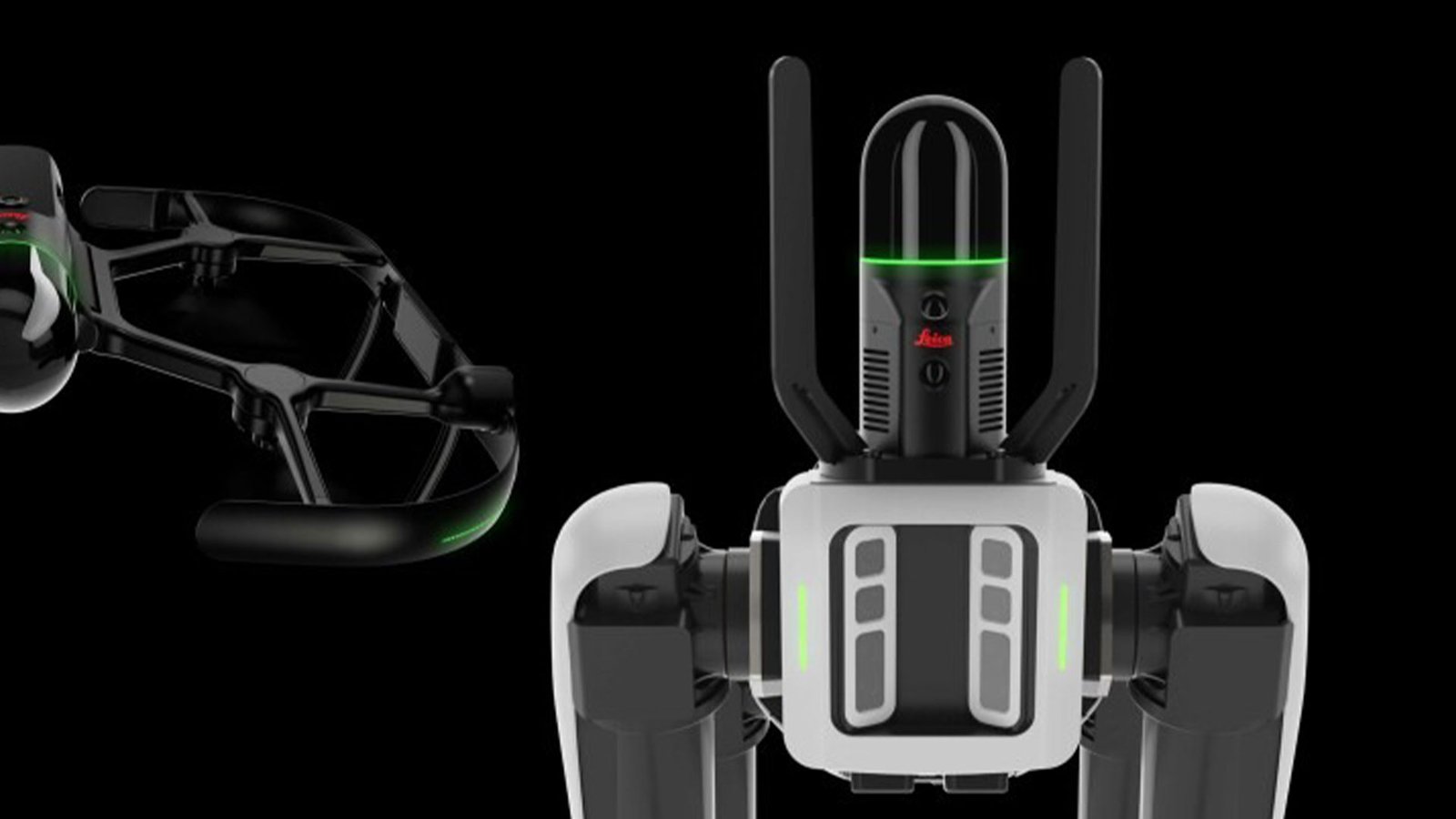
Leica BLK ARC

Robotic autonomous laser scanning module for fully automated data capture workflows.

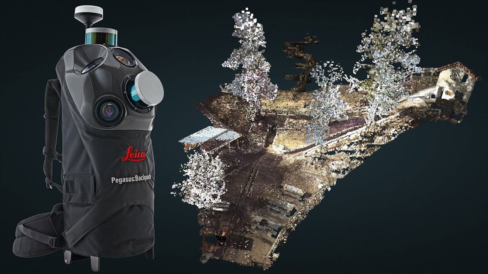
Leica Pegasus Backpack

Advanced mobile mapping system combining GNSS, LiDAR, and imaging sensors for large-scale reality capture.

Get in Touch Today for a Free Consultation

Copyright © 2026 Avrdus Technologies. All Rights Reserved

— BOOK A FREE

LiDAR
Consultation

Tell us about your project and our experts will recommend the right 3D scanning solution for your needs.

Experts
0 +
LiDAR Scanners
0 +

Pan-India

Presence

🔒 We respect your privacy. No spam, we promise. 

Prefer to chat? Chat with us on WhatsApp ›